
Rockaway Township ZIP Code Coverage
The working Rockaway Township ZIP code list keeps a deliberate distinction between official township-facing examples and working postal candidates. USPS is the controlling address verifier. The official polling-place material supports the first three codes below for township-facing locations. The remaining entries are useful places to test, not confirmed township-wide coverage. Do not turn a postal label into a boundary claim without checking a complete current address.
| ZIP | Areas Covered | Post Office | Notes |
|---|---|---|---|
| 07866 | Rockaway, including township municipal and central-area addresses | Rockaway postal route | Official township examples; verify street and number |
| 07801 | Dover postal city and Mount Pleasant polling example | Dover postal route | Township polling location can use Dover 07801 |
| 07435 | Newfoundland and Green Pond polling example | Newfoundland postal route | Township-facing address with a Newfoundland label |
| 07842 | Hibernia postal community or PO Box route | Hibernia postal route | Working item, current street extent unverified |
| 07438 | Oak Ridge postal community | Oak Ridge postal route | Working item, verify by full address |
| 07405 | Butler postal community | Butler postal route | Working item, verify by full address |
| 07005 | Boonton postal community | Boonton postal route | Working item, verify by full address |
| 07885 | Wharton postal community | Wharton postal route | Working item, verify by full address |
No official municipal ZIP-boundary map was located, and the USPS city/state search was not completed for every postal city during the research. Preserve this uncertainty. A ZIP match validates a delivery address, not township residency, municipal jurisdiction, or a complete list of people tied to that code.
Rockaway Township ZIP Code Postal Geography
Rockaway Township is a legal municipality in Morris County and is separate from Rockaway Borough. Postal city names cut across that identity. The county's polling-location page gives examples that make the mismatch clear: Ward 1 uses Faith Family Fellowship, 126 Mount Pleasant Avenue, Dover 07801; Ward 6 uses Green Pond Bible Chapel, 1083 Green Pond Road, Newfoundland 07435. Other township locations use Rockaway 07866.
New Jersey's polling-place search supplies the postal address route that illustrates why a Rockaway Township ZIP code needs municipal confirmation.
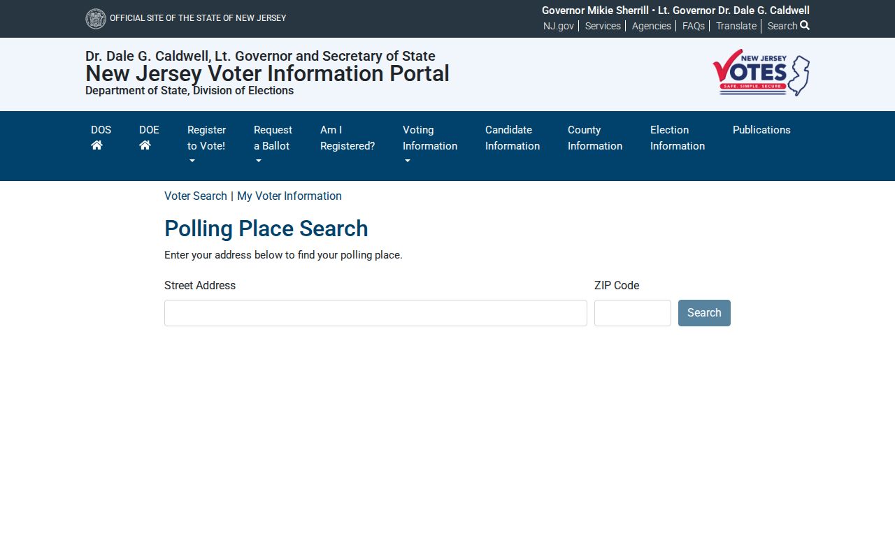
Use a polling address as a geography example only. It does not identify the people who live nearby, and it does not convert a postal city into the municipality.
Verify a Rockaway Township ZIP Code by Address
The USPS ZIP Lookup has three useful modes. ZIP Code by Address requires a street address; company is optional and apartment or suite information is optional but important when more than one match is possible. ZIP Code by City and State requires both fields. Cities by ZIP Code starts with the ZIP. The result can standardize the address, but USPS states that it does not prove a person or company is at that address.
| ZIP Code by Address | Street Address required; Company and Apt/Suite/Other optional; city, state, urbanization, and ZIP controls shown. |
|---|---|
| ZIP Code by City and State | City and State required. |
| Cities by ZIP Code | ZIP required; results can display 10, 20, or 30 per page. |
| Result use | Postal standardization and delivery lookup, not municipal or residency proof. |
USPS ZIP Code basics explains delivery precision behind a Rockaway Township ZIP code search.
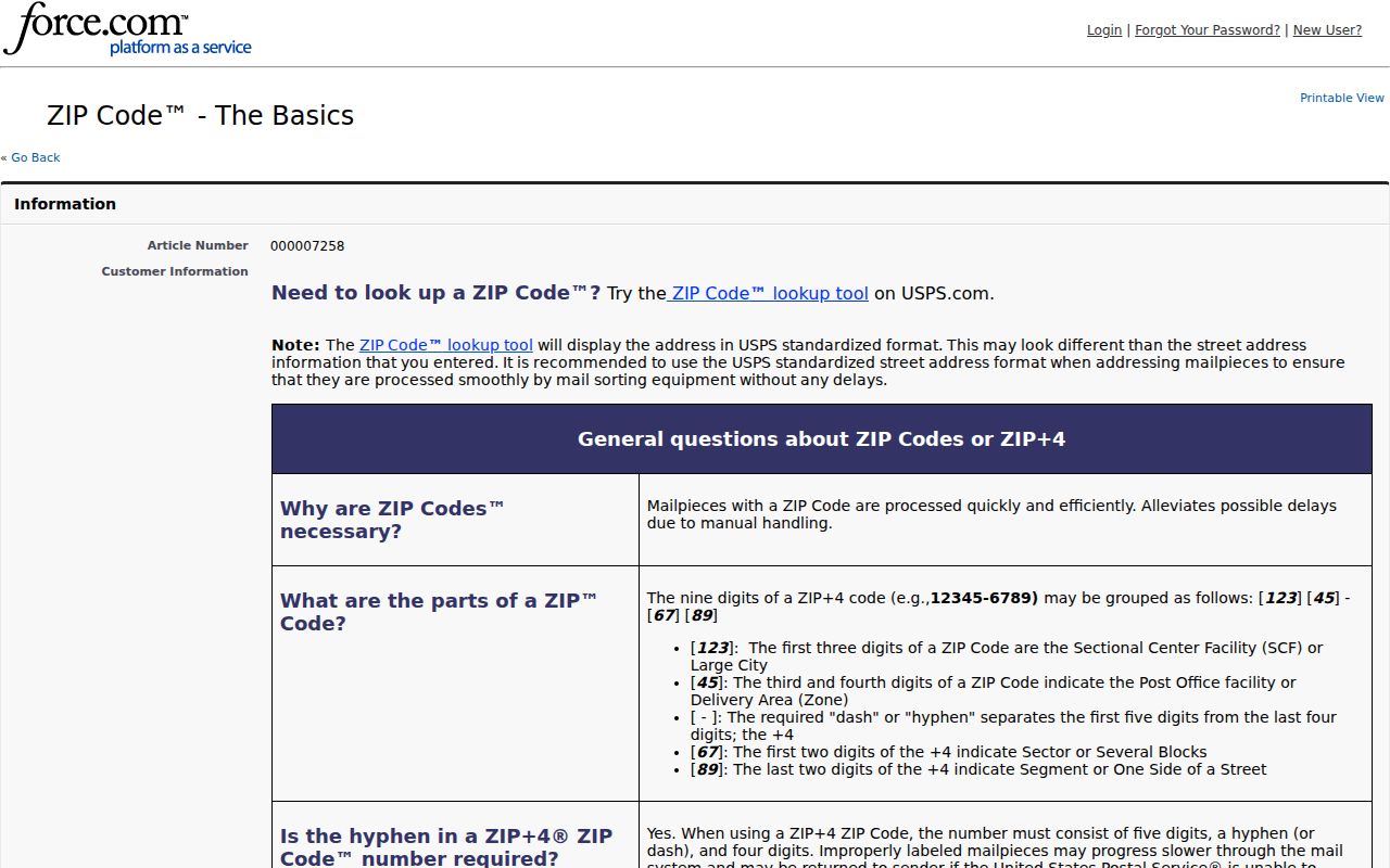
Keep the full response with the search date. A later address correction, unit number, or delivery change can alter what USPS returns.
Rockaway Township ZIP Code Municipality Check
After USPS, use the New Jersey municipality address lookup. It takes street address, city, state, and an optional ZIP, then offers lookup and suggestions. This is the practical defense against confusing Rockaway Township with Rockaway Borough or treating a postal city as the governing municipality. It should be used with the actual house number, not a broad code-only search.
The state municipality lookup supplies the next step after the USPS Rockaway Township ZIP code result.
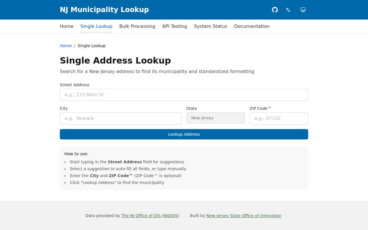
Save the municipal response alongside the postal result. When they use different place names, the difference is useful evidence of postal geography rather than an error to erase.
Find Records Within a Rockaway Township ZIP Code
No inspected local portal offered a confirmed public ZIP-wide resident search. Convert the postal code into an address and parcel workflow instead. The Tax Board has district, street, owner, block/lot, and prior block/lot modes, while Morris GIS accepts street address, municipality, owner, or parcel ID. The public voter tool is based on name and birth month/year, not a ZIP roster. That limitation prevents a ZIP code directory from implying a list that the sources do not publish.
- Enter the complete address, including unit information, in USPS ZIP Lookup and save the standardized response.
- Run the address through the state municipality lookup to confirm Rockaway Township rather than a postal or borough label.
- Use the NJGIN geocoder to normalize spelling and compare the returned municipality and ZIP.
- Search the Tax Board by district and street or by block and lot, then keep situs and mailing addresses distinct.
- Open the GIS parcel view and confirm block, lot, PIN, or geometry before using a Clerk legal description for historical context.
Once a ZIP code result narrows the work to a named street, the Rockaway Township street directory has the fuller address-by-address record chain.
Rockaway Township ZIP Code Tax Board Limits
The Morris County Tax Board search does not expose a ZIP field in its inspected modes. That is important: entering a postal city or a ZIP in an unrelated field can produce a misleading miss. Search by the municipal district and a location, owner, block and lot, or prior block and lot. The prior identifier can help where a subdivision or historic parcel conversion changed the current parcel key.
| District | Municipal tax district, not a postal ZIP field. |
|---|---|
| Street | Address-based route after USPS and municipality confirmation. |
| Owner | Owner-name route, not proof of occupant identity. |
| Block / lot | Parcel identifiers for a specific property. |
| Prior block / lot | Useful historical route where the current parcel key changed. |
The Tax Board record is a parcel source. A mailing address may differ from the situs address, and neither field is a ZIP-wide people search.
Rockaway Township ZIP Code Geocoding Checks
The NJGIN geocoder provides single-address candidates, suggestions, reverse geocoding, and batch services. Its source data is updated monthly, and batches are capped at 1,000. For one Rockaway Township ZIP code question, use a single candidate result to normalize a street spelling and compare match quality. It is a location tool, not a title record or a resident list.
NJGIN geocoding supplies the address-normalization step in the local ZIP code workflow.
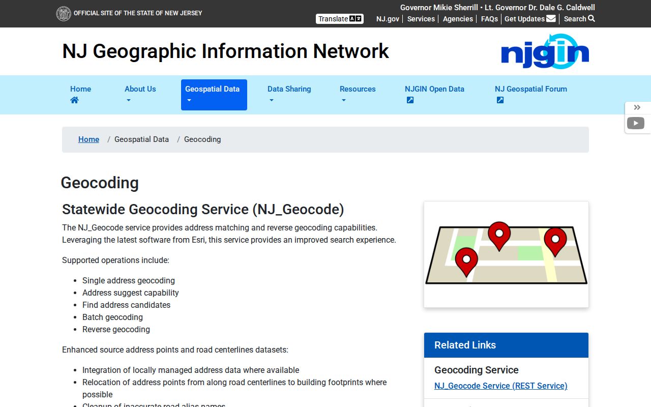
Compare the candidate's returned municipality and ZIP with USPS before moving to parcel research. Keep the search date because source data is updated monthly.
NJGIN Property Explorer is the statewide parcel and address companion to the Rockaway Township ZIP code check.
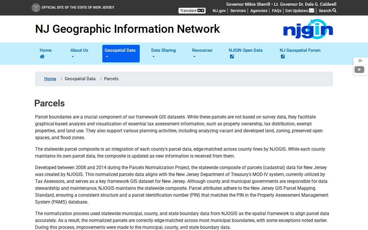
Property Explorer can search address, county, municipality, block, and lot. Confirm its parcel context against the current Tax Board and Clerk records.
Rockaway Township ZIP Code Historical Headings
Postal terms and historic headings do not stay still. The Morris County historic survey and maps material says Rockaway Township was established in 1844 and identifies an 1868 county map. That map is useful for old roads and village names before modern parcel systems. Search Hibernia, Mount Hope, Green Pond, Marcella, Newfoundland, Dover, Port Oram, and Rockaway as possible historical or postal headings, then reconcile them with the modern municipality and parcel.
The county announced a new official map on January 8, 2026, adopted December 17, 2025, to update its 2007 map. It is a current orientation source, not proof of parcel title. Date any map used in a Rockaway Township ZIP code note, especially where current roads or flood layers affect the address context.
For an old address that fails a present-day ZIP code check, keep the original heading and try the historic map, both township and borough labels, the prior block and lot, and the deed legal description. No official comprehensive dated street-renumbering register was located, so a failed modern match should remain an unresolved address question until an Engineering, Clerk, or parcel source confirms the link.
Rockaway Township ZIP Code Boundary Limits
A ZIP code is a postal delivery tool. It does not define a municipality, a legal parcel, an election district, or a complete group of residents. The municipal identity comes from the address check, and the parcel identity comes from block, lot, PIN, legal description, and current custodian records. Respecting those distinctions prevents a false match when one Rockaway label appears in more than one place.
- ZIP versus ZIP+4
- A basic delivery code versus a longer postal code that adds delivery precision. ZIP+4 is not a municipal or parcel boundary.
- PO Box ZIP
- A postal code used for post-office box delivery. It does not describe all street delivery in a place.
- Unique ZIP
- A code used for a single organization or special delivery arrangement, when USPS assigns one.
- Carrier route
- A delivery grouping used by postal operations. It is not a civil boundary or public resident roster.